This article first appeared in the Fall 2020 issue of Pennsylvania Chapter American Fisheries Society Newsletter.

Flowing through Chester County’s mushroom region, White Clay Creek is a heavily branched stream that meets the Christina River before joining the Delaware River near Wilmington, Delaware. In its eastern branch headwaters, the creek is the subject of a restoration study on a time scale rarely applied to streams or rivers anywhere in the world.
Stroud Water Research Center, located along the East Branch of White Clay Creek in Avondale, Pennsylvania, studies streams and rivers throughout the Commonwealth, the U.S., and the world. In 1981, the Stroud Center and this nearly 2,000 acre drainage basin were designated an Experimental Ecological Reserve by the National Science Foundation (NSF). This designation recognized that an internationally-acclaimed freshwater research facility, paired with a relatively healthy Piedmont stream, offered a rare opportunity for long-term experimental research on a watershed ecosystem that is an outstanding representative of its type.
The East Branch of White Clay Creek is classified by the Commonwealth of Pennsylvania as an Exceptional Value stream and watershed. This is the highest classification given and affords the watershed special protection against environmental disturbance of anthropogenic origin.
In 1998, the White Clay Creek experimental watershed, extending from the Stroud Center north to the headwaters, was designated as a site for long-term research in environmental biology (LTREB). The NSF’s LTREB program recognizes that many important questions in ecology require long-term data. NSF funds help the Stroud Center maintain an ongoing research project examining stream and watershed characteristics associated with reforestation of its riparian zone.
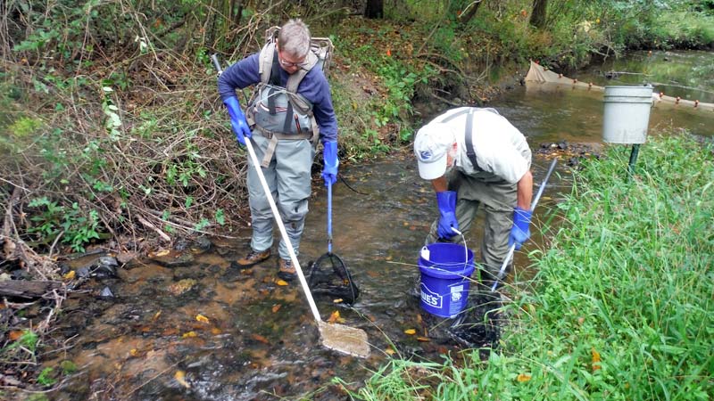
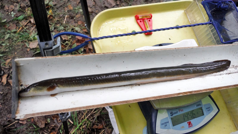
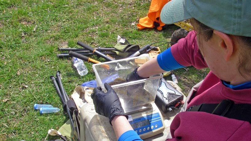
Collection of physical, chemical, and biological data (including fish and macroinvertebrate communities) provides a comprehensive picture of a watershed’s response to riparian reforestation absent other forms of stream channel and floodplain restoration practices.
The White Clay Creek watershed, like most of the eastern North American landscape, experienced dramatic anthropogenic disturbances over a relatively short time period (300 years). These are characterized by deforestation for lumber, charcoal, and agriculture, and more recently increases in impervious surfaces, pesticide, fertilizer, and snow melt product usage, and atmospheric deposition of nitrogen from the combustion of fossil fuels.
These landscape and land use changes have stressed stream ecosystems, yet little is known about how streams in the Piedmont physiographic province have responded to these stresses. Even less is known about how streams respond as the disturbed landscapes recover.
Changes in riparian zone vegetation have been pronounced. When the Stroud Center was established in 1967, the agriculturally dominated watershed contained an upstream riparian forest of 60- to 100-year-old trees and downstream meadows subject to cattle grazing.
Initially, several long-term sampling reaches on White Clay Creek were selected, including protected woodland and meadow reaches. When cattle were removed from the meadow reach adjacent to the laboratory, the riparian zone became overgrown by multiflora rose (Rosa multiflora), an invasive plant introduced into the U.S. in 1866.
In 1989, the Stroud Center began a riparian zone reforestation project with the goal of reestablishing a contiguous deciduous forest from the meadow reach to headwater spring seeps. Multiflora rose plants were uprooted, tree seedlings of native species were planted, and groundwater and in-stream sampling sites were established. Farther downstream, the Stroud Center maintains a long-term meadow reach without trees as a third riparian condition for study.
Signs of Recovery
Stroud Center scientists have observed that the stream in the reforested reach is changing — becoming wider such that riffles are shallower with more rocks protruding out of the water and pools with a wide variety of depths. All of this provides more and better bottom habitat for stream organisms like algae, freshwater insects, and fish. Learn more about the LTREB project: