The Watershed

While Stroud scientists have long been engaged in studying rivers around the globe, the heart of their enterprise has always been the East Branch of White Clay Creek.
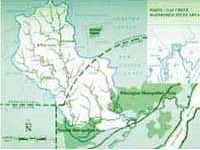
A quiet stream that runs past the Stroud Center, the East Branch drains an 1,800-acre basin in southern Chester County, about 45 miles from Philadelphia. The entire White Clay watershed covers 100 square miles in Pennsylvania and Delaware, with the creek itself flowing southeast to the Christina River in Newport and on into the Delaware River at Wilmington.
The Pennsylvania side of the watershed is still largely rural, although it is experiencing rapid development. The population of the White Clay’s drainage basin doubled between 1960 and 1990, and it is expected to double again by 2020, making it the fastest growing part of Chester County. Because most of the new growth involves the conversion of farms and woodlands to large-lot residential and commercial sites, open land will disappear even faster than the population will grow. With its developed acreage slated to triple by 2020, the watershed faces the highest rate of loss in the county.

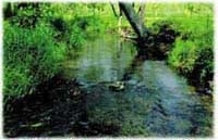
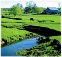
Still, the watershed remains a beautiful, if threatened and fragile, place. Large stretches of the East Branch continue to flow through green meadows, along corn rows and hay fields, and in and out of small hardwood forests.
The National Science Foundation designated the watershed around the Stroud Water Research Center an Experimental Ecological Reserve in 1981. Three years later Pennsylvania named the East Branch an Exceptional Value Stream, its highest water-quality designation.
And in 1998, the National Science Foundation included the Center and its watershed among its 35 sites in the prestigious “Long-Term Research in Environmental Biology” program.

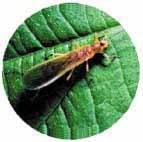
The creek contains about 20 species of fish, hundreds of species of algae and insects, and an unknown but immense number of species of bacteria and fungi. Although most are not visible to the naked eye, the various organisms all play critical parts in the life and health of a stream, and the functioning of the system depends on each of the species fulfilling its role.
After three decades of intensive study, the scientists at Stroud have come to know the East Branch with an unusual intimacy. Their access was simplified by the fact that the watershed’s 1,800 acres belonged to only about a dozen property owners, almost all of them sympathetic to the Center’s research aims and intent on keeping the land open. Thus, the scientists were able to plan long-term experiments with considerable confidence.

Under a five-year grant from the Rockefeller Foundation that began in 1969, they gathered extensive data on almost every aspect of stream life and many important characteristics of the watershed. Their experimental sites ranged in size from a single riffle and pool to the entire stream. They looked beyond the creek’s banks to the impact of farming and industrial practices; and they studied the importance of streamside forests as natural buffers against pollution from poor land-use practices.
Out of that work, which continues to this day, came an extraordinary set of baseline data from which the Stroud staff has been able to construct an unparalleled portrait of a stream and its watershed.
Learn More About Our History
The Beginning | The Watershed | Landmark Research | Art and Science | Road to Independence | Building Blocks
Celebrate Stroud Water Research Center’s history — from its humble beginning in Joan and Dick Stroud’s garage to a world-renowned freshwater research institution — with our anniversary book, The First Fifty Years.
