
Tools
WikiWatershed Toolkit
Expanding Access to Water Quality Monitoring
Globally, more than 3 billion people lack water quality data. Expanding access to monitoring tools helps communities protect their water and safeguard public health.
Through the WikiWatershed Toolkit, Stroud Water Research Center empowers scientists, educators, and community members to collect data and better understand the health of their waterways.
Tools for Modeling Stormwater Runoff and Water Quality Impacts
Model My Watershed
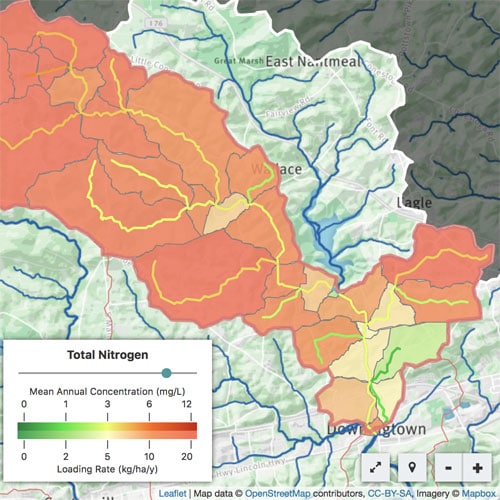
A professional-grade web app that lets you analyze real land use and soil data, model stormwater runoff, and compare how conservation or development scenarios could modify runoff and water quality.
Runoff Simulation
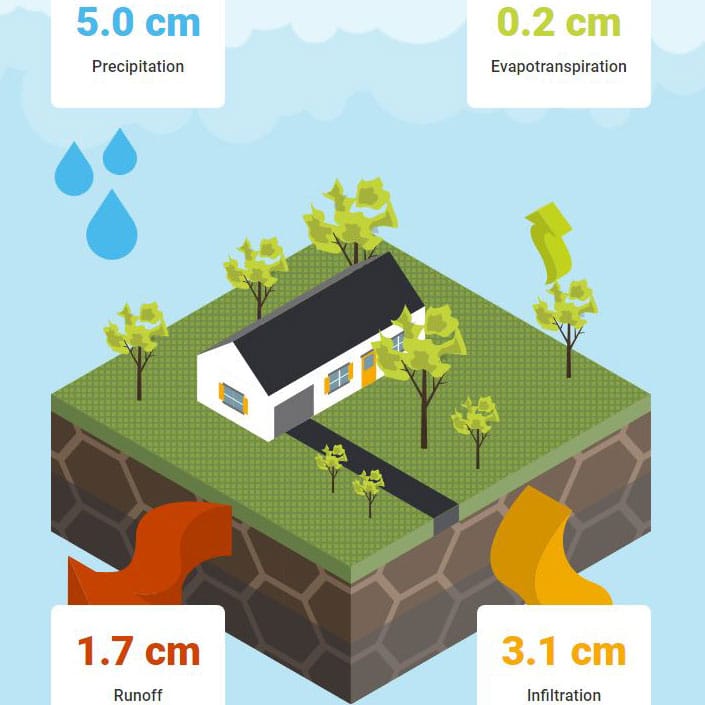
An animated educational tool demonstrates how land use and soil together determine whether rainfall infiltrates the soil, runs off into streams, or is evaporated or transpired by plants.

Tools for Real-Time Water Quality Monitoring
EnviroDIY
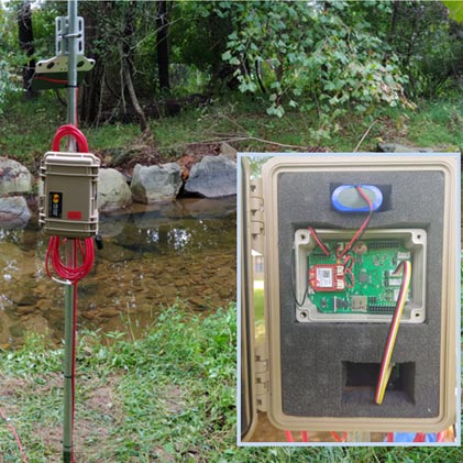
A community of enthusiasts that shares open-source ideas, asks and answers questions, and develops do-it-yourself environmental science and monitoring devices.
Monitor My Watershed
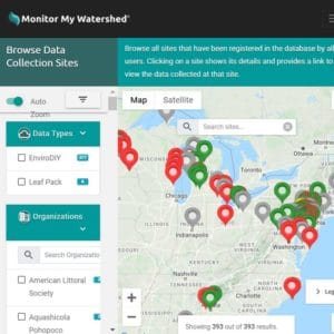
An online data portal that lets you share and explore real-time sensor data from EnviroDIY and macroinvertebrate data from the Leaf Pack Network.

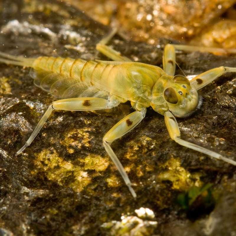
Tools for Using Macroinvertebrates to Assess Water Quality
Leaf Pack Network
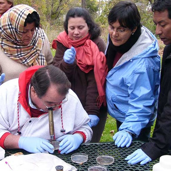
An international network of people investigating their local stream ecosystems through boots-in-the-water projects.
Leaf Pack Network Simulation
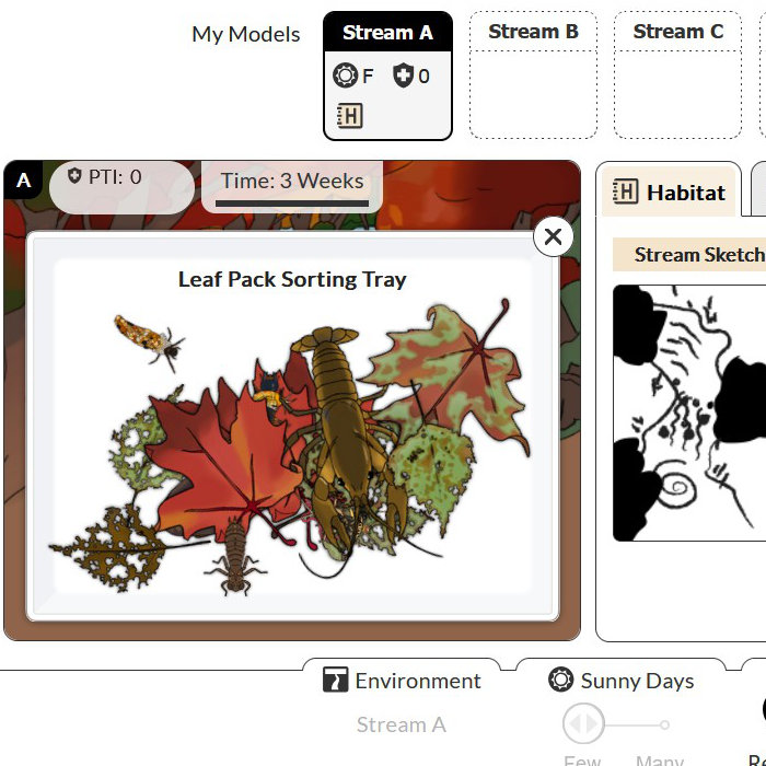
A web app in a field notebook format that allows those without access to a stream to perform a virtual Leaf Pack Network stream study.
Macroinvertebrates.org
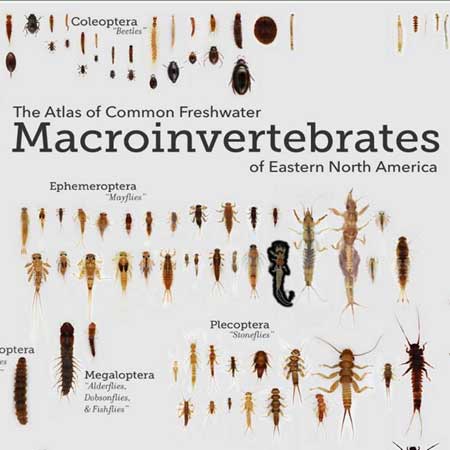
An open educational resource to support citizen science water quality biomonitoring, including web and mobile apps for identifying common freshwater macroinvertebrates.
WaterQuality Mobile app
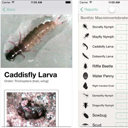
A mobile app for recording stream study data in a general or Leaf Pack Network report. Users of all ages can learn about macroinvertebrate water quality indicators through pictures, sketches, and short videos.
Partnerships
Taxonomic Certification
The Society for Freshwater Science Taxonomic Certification Program ensures that skilled individuals provide aquatic invertebrate identifications in North America.
Scientific Assistance to Watersheds
The Consortium for Scientific Assistance to Watersheds (C-SAW) provides free technical assistance to Pennsylvania-based watershed and conservation organizations.