Volunteers Capture Salt Pollution at Baseflow, Months After Winter Salting
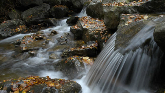
Before the morning mist had cleared on October 1, volunteers were already walking to creek banks with clean bottles and field forms. The Fall Salt Snapshot, organized by Stroud Water Research Center with nearly 100 partner organizations from across the mid-Atlantic, asked a simple question with big stakes: what does baseflow chemistry tell us about the lingering impacts of road salt pollution, long after the snow is gone and salting has ended?
By the end of the two-week window, community science volunteers had logged 900 sites, with more still coming in as teams finish up.
Pairing January’s surge with October’s steady state helps communities calibrate smart salting. Using the right material, at the right time, in the right amount is the best way to ensure both road safety and clean water.
Honoring the Past, Preserving the Future
At Newlin Grist Mill in Delaware County, Pennsylvania, history set the tone. A 1704 mill still anchors the site, and water still powers the mission. On day one, 11 volunteers stepped off in Concord Township, covering 22 sites on West Branch Chester Creek, Concord/Web Creek, Deborah’s Run, and Green Creek.
“Water is an important part of everything we do — from operating our 1704 historic mill to education and our trout fishing program,” said Jessica Shahan, naturalist and volunteer coordinator. “January’s snapshot confirmed problem areas and even revealed a salt source we hadn’t identified. With October samples, we can judge the magnitude of winter salt impacts and target future projects.”
Her team’s baseflow samples help create a fuller picture for local decisions by connecting winter salt peaks to autumn’s background levels.
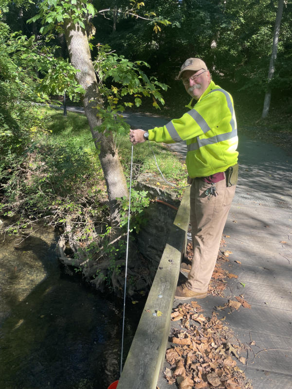
A few days later in Valley Forge National Historical Park, the past felt close for a different reason. Valley Forge Trout Unlimited (VFTU) spread out across more than 50 Valley Creek sites on October 4 and again on October 11. Area springs keep the cherished creek’s water cold and clear, allowing wild trout to still inhabit them — a reminder of when Valley Creek fed George Washington’s army.
“Valley Creek is the crown jewel among Chester County streams,” said Peter Hughes of VFTU. “The level of salt has been rising over the years and is a major threat to the trout and their food sources.”
With about 20 volunteers and a senior scientist logging readings, VFTU didn’t just collect numbers; they followed the clues, prepared to trace unexpected spikes to likely sources.

Engaging New Volunteers
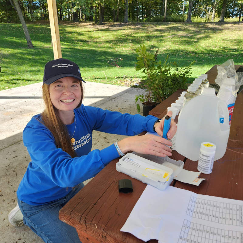
Pennsylvania Sea Grant teams carried the effort from Philadelphia to Erie. In the northwest, Amber Stilwell coordinated Penn State Extension Master Watershed Stewards who gathered 12 samples from French Creek and nearby urban and rural streams.
“It was a great way to spend a fall day contributing to a statewide community science dataset,” Stilwell shared on Facebook.
As both Sea Grant outreach specialist and MWS coordinator for Crawford, Erie, and Warren counties, she sees this work as a first step into water-testing protocols for many new volunteers — and a reason to come back.
First-timers were part of the story at Lehigh Gap Nature Center too. The team started small — three sites, a handful of photos, and a note from Anna Costello: the tutorials were clear, the day was beautiful, and “thanks for getting me out of the office.”
In Chester and Delaware counties, organizers worked together to make it easier for neighbors to contribute samples and points on the public salt map.
They provided simple sign-ups, clear how-to videos, and county drop-off locations hosted by Widener University, Penn State Extension Master Watershed Stewards led by Meagan Hopkins-Doerr, Delaware County, Delaware County Conservation District, Upper Chichester Township, Willistown Conservation Trust, and Newlin Grist Mill.
“Volunteers are highly engaged in this activity, and appreciate the opportunity to learn another key aspect of water quality,” said Amanda Goldsmith, watershed specialist for Lancaster County Conservation District.
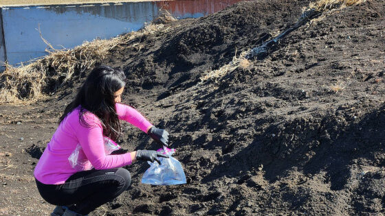
LCCD staff and 20 volunteers collected 43 samples across all of Lancaster County’s watersheds, finding at least one salty hotspot in a farming community, where salt is normally expected to be lower.
Mentorship in the Field
For some, collecting stream data was an opportunity to learn, grow, and discover the world around them. On October 11 in Delaware County, Martin Kelly, who volunteers with Big Brothers Big Sisters, and his Little Brother Zahir joined Master Watershed Steward Susan Day at Foxes Run, Hildacy Preserve, and the Folsom Boys Club in Delaware County.
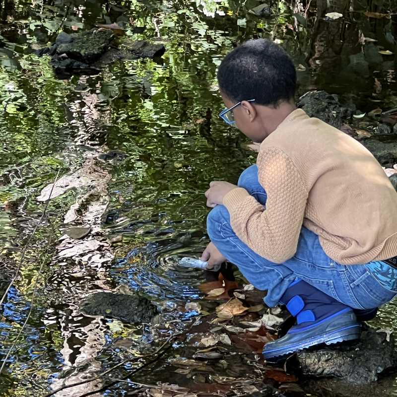
Flows were low and steady — perfect for baseflow sampling — but access wasn’t always easy. Erosion and steep slopes turned navigation into a small adventure.
Day taught technique, and Zahir took the map and logged latitude/longitude on the field forms prepared with guidance from Lauren McGrath at Willistown Conservation Trust.
The questions came quickly: How does salt change a creek? What happens to macroinvertebrates, the insects trout depend on? In Zahir’s curiosity, one could see the next generation of stream stewards forming.
Across the Miles
Road salt is a shared challenge that crosses county and state lines. In New York’s Southern Tier, partners at Southern Tier 8 and the Broome-Tioga Stormwater Coalition extended the reach northward. The Sparta Environmental Commission and Foodshed Alliance’s Paulins Kill Watershed in New Jersey covered areas to the northeast. Southward, Patapsco Valley Heritage Area in Maryland joined the effort.
What’s Next
As remaining samples arrive, the Stroud Center will complete quality control and add results to the public salt map, helping partners turn observations into action. Results can inform targeted outreach, better materials and application rates, and repairs where infrastructure funnels salt where it doesn’t belong.
Ultimately, the story belongs to the people who waded, measured, labeled, and learned. Thank you to everyone who joined us for the Fall Salt Snapshot. You’re helping to protect water in your community and for everyone downstream.
Take Action
- Watch the fall snapshot wrap-up recording or view the interactive salt map.
- Follow updates and find resources on how you can Cut the Salt.
- Donate today to help fund more community science events like the Fall Salt Snapshot.
Thank you to everyone who joined us for the Fall Salt Snapshot: Abington Friends School ~ Angelica Creek Watershed Association ~ Aquashicola Pohopoco Watershed Conservancy ~ Brodhead Watershed Association ~ Broome-Tioga Stormwater Commission ~ Chartiers Creek Watershed Association ~ Chesapeake Bay Foundation ~ Chester County Conservation District ~ City of Obetz, Ohio ~ CRC Watersheds (Chester, Ridley, and Crum Creek) ~ Delaware County Office of Sustainability ~ Delaware Riverkeeper Network ~ Dunwoody Village ~ Elk Creeks Watershed Association and Bennett’s Run at Kendal-Crosslands ~ First State National Historical Park/White Clay Watershed Stewards ~ Foodshed Alliance ~ Friends of Little Crum Creek Park ~ Friends of the Wissahickon ~ Great Marsh Institute ~ Green Team West Chester, Pa. ~ Greenprint Club ~ Henderson High School ~ Kennett Township Environmental Advisory Council ~ Keystone Water Resources Center ~ Lancaster County Conservation District ~ Lehigh Gap Nature Center ~ Lewis County Soil and Water Conservation District ~ Little Lehigh Watershed Stewards ~ Lower Merion Conservancy ~ Master Watershed Stewards – Adams County ~ Master Watershed Stewards – Berks County ~ Master Watershed Stewards – Chester County ~ Master Watershed Stewards – Delaware County ~ Master Watershed Stewards – Erie, Crawford, and Warren Counties ~ Master Watershed Stewards – Lackawanna and Luzerne Counties ~ Master Watershed Stewards – Montgomery County ~ Master Watershed Stewards – Penn State Extension ~ Master Watershed Stewards – Philadelphia ~ Master Watershed Stewards – York County ~ The Miquon School ~ Monocacy Creek Watershed Association ~ Musconetcong Watershed Association ~ The Nature Conservancy/The National Park Service (Delaware) ~ Neshaminy Watershed Association ~ Neumann University ~ Newlin Grist Mill ~ Newtown Creek Coalition ~ Patapsco Heritage Greenway ~ Pennsylvania Sea Grant ~ Penn State University ~ Penn State Brandywine ~ Pennsylvania Environmental Literacy Network, Northwest Region ~ Pickering Creek Samplers ~ Primrose Creek Watershed Association ~ Radnor Middle School ~ Recycling Services, Inc. ~ Rose Valley Environmental Action Committee ~ Saucon Creeks Watershed Association ~ Southern Tier 8 Regional Planning Board ~ Stewards of Twin Lakes ~ Tookany-Tacony/Frankford Watershed Partnership ~ Tredyffrin Township Environmental Action Committee ~ Trout Unlimited – Perkiomen Valley ~ Trout Unlimited – Valley Forge ~ Tulpehocken Creek Watershed Association ~ University of Pennsylvania ~ Villanova Center for Resilient Waters ~ Wallkill River Watershed Management Group ~ Watershed Alliance of Adams County ~ West Chester University of Pennsylvania ~ Widener University ~ Willistown Conservation Trust ~ Wissahickon Environmental Center ~ 11 unaffiliated individuals