By Scott H. Ensign, Ph.D.
Whose Mud Is It?
DNA Evidence Helps Focus Bay Clean-Up Efforts
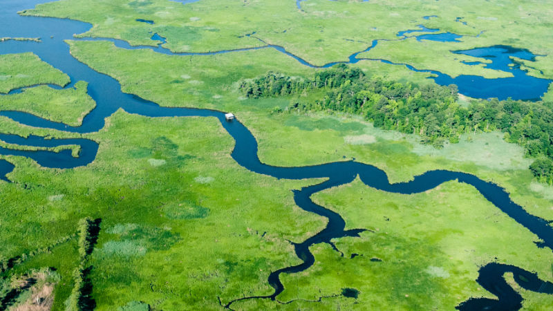
You’ve seen it before: a muddy river raging below a bridge after an intense storm, then a brown plume spreading into the bay downstream. That sediment might nourish the tidal wetlands lining the river’s banks, but it could also cloud the water and smother seagrass beds and oyster reefs farther toward the sea. And one nagging question underpins management plans to reduce sediment pollution to these coastal areas: Where is all that mud coming from? The river or the estuary?
It’s a question that has stumped scientists and complicated efforts to manage bays and estuaries for decades.
A recent study by Stroud Water Research Center cracked the case using methods borrowed from a murder mystery.
The intersection between rivers and estuaries is a really messy place. In some estuaries, it is very hard to point your finger at the river as the source of sediment pollution. You need a way to measure exactly which particles come from the river and which come from the estuary.
DNA Fingerprints Reveal Sediment Origins
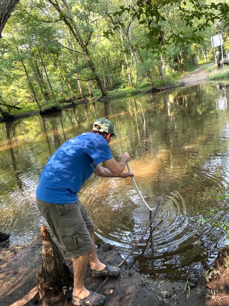
To track sediment’s journey, Dr. Jinjun Kan and I turned to a tool straight out of the forensic science toolkit: DNA. Every body of water — a headwater stream, a tidal creek, an open bay — harbors a microbial community with a unique DNA fingerprint. Sediment particles carry this fingerprint like a molecular passport stamped with their place of origin and an expiration date. By sequencing the DNA of microbes clinging to suspended particles collected during and after river floods, we could trace how far riverine sediment had actually traveled through the Choptank and Pocomoke River estuaries on Maryland’s Eastern Shore.
I remember shouting with excitement when we looked at the first sequencing results. It is rare to see such an obvious pattern in environmental data that can be corroborated with independent measurements.
Tidal Wetlands Trap Much of the River’s Mud
The results were clear. Following even large flood events, roughly half of the riverine sediment settled out within the first 10 kilometers of the estuary — intercepted by the tidal wetlands lining those upper reaches. Less than 30% of the river’s sediment signature made it to the saltier downstream zones where seagrasses grow. The findings suggest that river sediment is helping tidal wetlands survive rising sea levels by building elevation, while the wetlands themselves act as a natural buffer, catching most of the river’s load before it can reach sensitive seagrass beds.
What the Findings Mean for Bay Restoration
Armed with this information, estuary managers should expect a long delay before river-sediment load reductions in a watershed become apparent in the saltier water where seagrass grows. During those intervening years or decades, sediment-control efforts can focus on local hot spots of shoreline erosion.
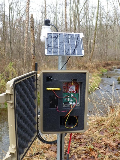
The research was a team effort that extended beyond the laboratory. ShoreRivers and the Assateague Coastal Trust, two Eastern Shore conservation nonprofits, helped manage a network of water sensors that measured sediment and saltwater concentration in the rivers. Real-time flood data was captured using EnviroDIY technologies and relayed to the Monitor My Watershed web app, providing the hydrological context needed to interpret the DNA fingerprinting results. The National Science Foundation funded the study.
My coauthor and I are careful to note that our conclusions apply specifically to the low-gradient, coastal-plain rivers typical of the mid- and South-Atlantic coastline, not to steeper piedmont rivers, where sediment dynamics differ. Extending this DNA fingerprinting approach to those systems is a natural next step.
Connecting River Science to Smarter Restoration
But even within its scope, this study matters beyond the coast. It bridges a longstanding gap between how we manage rivers and how we manage estuaries by helping ensure that our pollution targets match our restoration goals. It’s that efficiency between problem and solution that marks the Stroud Center’s approach to science and restoration across the watershed.
Your gift is an investment in programs that protect our world’s freshwater sources upon which life depends. Support science today for water tomorrow.