This is the second article in a series on Stroud Water Research Center’s scientific expedition to the Fly River in Papua New Guinea. To read the articles in order:
- Pursuing Science Half a World Away: The Fly River in Papua New Guinea
- Unearthing Buried Treasure in Papua New Guinea
- River Are Not Pipes
By Patricia McAdams
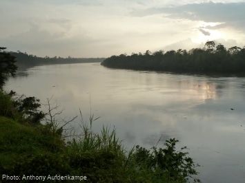
Two weeks into their work in Papua New Guinea, Dr. Anthony Aufdenkampe and his colleagues had already surveyed more than 600 miles of remote jungle rivers, motoring up and down the Fly River and many of its tributaries in their dinghies. They had macheted trails through rainforests, climbed rocky cliffs, and dug more samples of soil than they could count. They had driven through swampy jungles and crossed perilous bridges that were nothing more than logs — or ropes — stretched across a river. They were tired, dirty, hungry, and thirsty — but reeling with excitement over unprecedented discoveries in recent days.
Aufdenkampe, director of organic and isotope geochemistry at Stroud Water Research Center, traveled to Papua New Guinea to seek evidence of the deposition of river-borne carbon in the Fly River. Of all rivers measured, the Fly ranks as one of the top 10 rivers in the world for carbon and sediment discharge.
“Carbon is the building block of life and our key energy source,” Aufdenkampe says. “Plants store the sun’s energy in carbon, like a battery. But when plants, animals, and humans use that energy, we also release greenhouse gases. Knowing how much carbon is stored, and where, and for how long, is critical information for policy-makers grappling with the impacts of human-induced climate change.”
Joining Aufdenkampe were Dr. Rolf Aalto and his graduate student Michael Grenfell from the University of Exeter in the U.K.; Dr. Miguel Goni from Oregon State University; and Dr. Wes Lauer from Seattle University. Among other things, this international team hoped to collaborate in unraveling the puzzle of carbon burial in response to sea level rise along the Fly River. They then could use this river as a proxy to better understand other tropical rivers.
“As rivers move, they recycle and store a lot of sediment and buried with that sediment is a considerable amount of carbon,” says Aufdenkampe. “The question is: How much carbon? As the primary ingredient in greenhouse gases, the answer to this question is becoming increasingly relevant to understanding our changing climate. Only by combining the diverse talents and expertise of our team can we answer those questions.”
While the team expected that many answers would await the tedious chemical analysis of soil samples after they returned to their labs, the huge surprise of the trip came from incredible geological discoveries hidden under the riverbed. In fact, these discoveries track carbon storage back across the pages of history and into the last ice age!
NEW TOOLS FOR A NEW CENTURY
One goal of this trip was to employ some exciting new technologies that are changing the face of research. Not only do these new tools allow researchers to work more efficiently, but smarter, as well, with astonishing adaptability in the field. One device, a sub-bottom sonar unit for rivers, in particular, opened the door to the past in ways never before possible, allowing the team to measure channel geometry in what Aalto calls “glorious real time.”
For many years, oceanographers had been using very large and powerful geophysical devices costing up to millions of dollars to image the ocean floor. Aalto knew these subbottom sonar devices had recently been shrunken in size and energy requirements, so he had the first of its kind custom built by SyQwest, Inc. This device was optimized specifically for the shallow water environments of the Fly River.
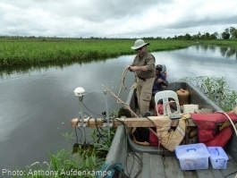
“This subbottom sonar unit was then combined with another type of geophysical unit — a side-scan sonar device also designed for rivers — that captured simple images of the riverbed, some 130 feet below the surface of the water in the deepest parts of the Fly. As we were cruising around, therefore, we were, first, producing beautiful centimeter-scale images of the bed of the river with this side-scan solar device.
“At the same time, the custom sub-bottom sonar unit was sending a powerful signal into the bottom of the river or lake, which then reflected back with incredible images, as though it were taking an MRI of the earth. Specialized sonar analysis software from Chesapeake Technology, Inc. then allowed us to produce high-resolution, spatially georeferenced maps of the geology to a depth of about 32 feet underneath the bed,” Aalto added. “For example, while profiling Lake Murray, we displayed an image of what is under the water. What we saw was a very shallow, very smooth lake bottom.
“Buried 20 feet underneath that lake bottom, however, we discovered a massive paleo-river channel, going down the center of the lake — a channel that was 60 feet deep and 1,100 feet across and about 30 feet lower than the present Strickland River. This discovery has many implications for how the rivers and lakes in Papua New Guinea responded to the last ice age 15,000 years ago.”
“It also means that 30 feet of carbon-rich mud has been accumulating in the floodplain all that time,” added Aufdenkampe.
“In other words, we now have visual evidence of a present, past, and prehistoric river channel location, elevation, and geometry,” says Aalto. “Nobody has ever done that before in a large river environment — anywhere!”
In interpreting these results, Aalto explained that everybody believes that a river goes back and forth visiting all the areas of a floodplain, because that’s what our textbooks say. But he thinks this is probably not true — at least not for large tropical rivers. This is a new idea. There’s a subtle distinction, but it’s actually important for how a river infills its floodplain with sediment and associated carbon, he says.
“What Rolf is actually saying,” Aufdenkampe added, “is that with the various new technologies we employed for the very first time, on any river system on earth, we may be beginning the process of altering the prevailing wisdom and rewriting textbooks in another five or 10 years.”
In fact, Aalto has since been writing the chapter about how floodplains form for Elsevier, a major scientific publisher, for Treatise on Geomorphology, their upcoming reference book for the entire field.
COMING BACK TO CAMP
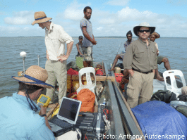
But now, bone-weary after another long day motoring on the strong, powerful river and sloshing through the muck of this water-saturated island, the team pulled into their campground. They began hauling their equipment from their boats to the elevated fishing huts, where they would spend the night. Seven feet off the ground, the huts were intended to discourage visits from the venomous snakes, ants, and other critters that roamed the forest floor.
As the team unpacked their boats, the tropical sun sank deeper into the sky, splashing it into soft, ever-changing shades of sunset. And then, as daylight melted further into dusk, the team watched as New Guinea’s native flying foxes emerged by the thousands from trees to begin foraging on hundreds of different kinds of rainforest fruit.
“Flying foxes are the world’s largest bats,” Aufdenkampe says. “With 4- to 5-foot wingspans, seeing hundreds of these at any given time swooping over the river is an amazing sight.”
In the tropics, night falls swiftly, and soon the team was bathed in darkness and silence, but for the hushed cacophony of the bats still flying about, and the quiet flapping in the river from crocodiles, which often got frisky at night. The team built a campfire, had a meager dinner of rice and canned meat, and then climbed into their bedrolls. Tomorrow they would be meeting with villagers in Atkamba to discuss the devastation to their land and water as wastes from big mining companies filled up more and more of their river valleys.

