Aufdenkampe, A.K., T.L. Bott, C.L. Dow, J.K. Jackson, L.A. Kaplan, A.E. Schuyler, and B.W. Sweeney. 2010. Stroud Water Research Center, Avondale, Pennsylvania.
This project compared the current state of 11 Bucks County, Pennsylvania streams with data collected from 1968–1971, before the Clean Water Act went into effect. Research comparisons will document whether the ecological condition of these streams has improved due to mandated reductions in point-source pollution discharges, deteriorated as a result of watershed development in Bucks County, or remained the same over time.
Executive Summary
A generally explicit goal of stream water-quality monitoring programs is to assess the state of current water quality in a given study region. Part of such an assessment is the obvious question ‘how have things changed?’ Too often, this question can only be answered through inference. For example, a relationship between current water-quality and current population could be used to predict historic water quality given the availability of historic population data. The applicability of such a prediction relies on the premise that the relationship between a measure of stream water quality and population does not change over time. In lieu of actual historically measured water-quality data, such predictions of historic water-quality based on some related measure of historic watershed conditions is the only viable option for answering the question ‘how have things changed?’
Due to forward-thinking individuals in the Division of Natural Resources of Bucks County, and Delaware Valley College in Doylestown, an extensive historic stream water-quality dataset exists for most of Bucks County, Pennsylvania. Launched in 1967, this innovative monitoring program had as a primary goal the establishment of a baseline of information on the health of the county’s stream and river ecosystems and the quality of their water. The temporal scale, with data collection occurring from 1967 through 1971, coupled with the spatial scale of 47 intensively-sampled sites along with another 72 synoptically-sampled sites made this an ambitious monitoring project. However, the truly innovative aspect of this historic monitoring program was the breadth of chemical and biological measures that comprised the sampling and the quantitative nature of the data collection. The vision of the monitoring program participants to approach the question of stream water quality from both a chemical and biological perspective makes the resulting dataset quite valuable as a baseline.
The historic monitoring program came in response to calls for the construction of flood control dams, water supply reservoirs and other measures that were intended to improve water quality in the county’s surface streams. Sampling stations included sites above and below towns and sewage treatment plants, at proposed dam construction sites and in rural settings for control purposes. At the end of the project (1971), the Clean Water Act was passed and the Environmental Protection Agency was established. In the intervening years pollution controls have been implemented, urban areas have expanded and some of the rural areas have been intensively developed. After the initial baseline data had been collected, the program was abandoned and these data were never fully analyzed or used for planning or evaluation purposes.
The primary objective of the historic monitoring program was simply to provide a stream water-quality baseline. Secondary objectives that arose as the project progressed were as follows:
- Assess the present (i.e. at that time) state of water quality across the entire County.
- Predict water quality trends that might accompany increasing urban/suburban development.
- Develop a program of water quality management for the County.
The initial study design established 35 sites across the County that were divided up among 5 categories defining similar location characteristics or study goals. These study site groupings included site locations relative to proposed dam sites or WWTP outfalls, sites within the Neshaminy watershed or on the Delaware River, and sites selected on small watersheds to characterize general, County-wide, water quality. Twelve additional sites were added in 1970 to provide supplemental data to that being collected at the original 35 study sites. Lastly, a host of new sites were added in 1970-71 which were synoptically sampled in an effort towards obtaining a spatially broader overview of county-wide stream water quality.
Stroud Water Research Center had three primary objectives in revisiting the historic Bucks Co stream water-quality monitoring work:
- Examine changes in water quality over the 40 years since the initial study.
- Add to the baseline of water-quality information that was established by the initial study.
- Use the historic and new baseline for piloting education programs related to water quality in Bucks County.
Re-visiting all 47 of the original study sites (not including the 72 synoptically-sampled sites) where the complete suite of historic chemical and biological sampling took place would have been ideal. However, financial limitations of the project required a greatly reduced scope in terms of the number of sites to sample for the current effort. The eleven sites chosen from the original 47 were selected to be representative of the types included in the historic effort including: urbanizing; up-stream v. down-stream of impoundments; small v. large watersheds; nested watersheds within the Neshaminy, and a control (i.e. minimally impacted) site. Examining changes in water quality hinged on re-sampling as many of the historical parameters as possible, especially the biological ones (i.e. macroinvertebrates, periphyton, and phytoplankton). Adding to the baseline of information required selecting new, cutting-edge parameters such as the class of organic compounds commonly referred to as molecular tracers (i.e. PAHs, Caffeine, etc) and Carbon and Nitrogen isotopes.
Of the 116 historic monitoring sites whose watersheds are primarily within Bucks County (i.e. not including the Delaware River monitoring sites), only 8 experienced a reduction in population from 1970 to 2000 based on U.S. Census data. The majority of the 116 sites (84) experienced at least a 50% increase in population over that time period. The 11 sites that were revisited in 2007/08 study period experienced an increase in the number of people of between 55 and 224%. Despite the already suburban nature of Bucks Co at the time of the historic study, these changes in population suggest that the County as a whole, and the 11 re-visited study sites specifically, experienced a good deal of urban/suburban growth over the 40 years since the initial water-quality monitoring study.
Highlighted findings from the current study:
- Phosphorus and sulfate, and to a lesser extent, alkalinity and pH showed the strongest regional changes among the chemical parameters measured both historically and in the present study. Reductions in phosphorus are likely due to the ban of phosphates in detergents in Pennsylvania in 1989 [Phosphate Detergent Act, Act of July 5, 1989 (P.L. 166, No. 31)]. The reduction in sulfate along with increases in pH an alkalinity may be tied to improvements made in air quality specifically to reduce acid deposition following an amendment to the Clean Air Act in 1990 that specifically dealt with acid deposition.
- Many molecular tracers such as polycyclic aromatic hydrocarbons (PAH), caffeine, fragrances, and fecal steroids were found in nearly every stream water sample collected in 2007/2008. In contrast, only one of three pesticides (atrazine) was found in nearly all samples. The other two pesticides, metalaxyl and chlorpyrifos, were found in less than a third of those samples. The three polychlorinated biphenyls (PCB) were found in only a few stream water samples. Selected molecular tracers as well as ratios of selected tracers were significantly and positively related to the change in population from 1970 to 2000 suggesting an association between watershed condition, and perhaps changes in watershed condition over time, to these very specific measures of contamination sources.
- Striking improvement in water quality based on fecal coliform density data was found between current and historic sampling efforts.
- Macroinvertebrate sampling suggests significant improvement in stream condition across most of the 11 sites sampled both historically and currently. This improvement comes despite increased watershed pressures as indicated by increased population densities for all 11 watersheds.
- Improvements in wastewater treatment from the historic study period to the current study period are suggested by decreases in live phytoplankton units (planktonic algae in the water column) between the two periods. However, an increase in live phytoplankton units was evident at a site below a stream impoundment (reservoir) built in the early 1970s. A decrease in live phytoplankton units suggests an improvement in water quality based on lower nutrient availability.
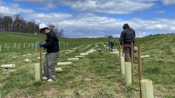
Complementing the research effort was education outreach conducted by Stroud Water Reseach Center educators that reach approximately 1000 teachers, student, and community organization volunteers in Bucks County. The goal of this effort was to educate Bucks County residents about the importance of their water resources and watersheds.
Acknowledgments
The authors of this report represent only a few of the many folks who contributed their hard work to the project. Without the dedication of the following employees and many summer interns, this project would never have gotten off the ground:
Melanie Arnold
Juliann Battle
Heather Brooks
Stephanie Dix
David Funk
George Dang
David Fralinger
Michael Gentile
William Milliken
David Montgomery
Sally Peirson
Ann Rhoads
Sherman Roberts
Lorae’ Simpson
Kyle Stem
Roberta Weber
Special thanks is extended to Bonnie Zobel who, as an intern from Delaware Valley College, hand-entered all of the historic data into digital files allowing for the permanent preservation of this valuable set of data. Also thanks to Drs. John Mertz and Ron Johnson of Delaware Valley College for valuable discussions and insights into the historical data and logistical help with various aspects of designing and executing the project.
We thank the many private land owners within the Bucks County watersheds we visited who allowed us to access streams on their property.
This project was funded by a grant under the National Aeronautic and Space Administration (NASA).